How do you find, map, and track yer routes? Below I’ve share my (evolving) approach to maps and navigation; including the apps and devices I use, but would love to hear what others are doing.
My Goals
- find new places
- plot the route for offroad or use generated route for road sections
- don’t get lost
- don’t depend on cell reception
- share my location with the wife / emergency
- remember & share great rides
My Tools
- Google Earth
- Google Maps
- Garmin InReach (gps device) & Earthmate (pairing App)
- Calimoto
- Garmin BaseCamp (new) with free OSM maps
Google Earth
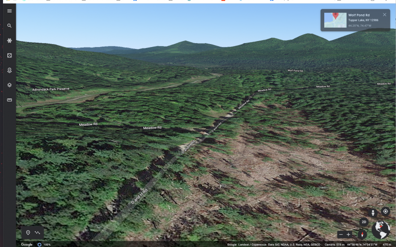
Why? Google earth is my recon tool. Try to get a sense of what might be before I get the chance to go. Sometimes it helps me find hidden gems, other times big disappointments. But especially if you’re looking for some logging/seasonal roads etc in a specific area, it’s great.

Google Maps
Why? I know I said “no cell reception” but when I have it and need to find food, gas, or lodging, maps is the obvious choice. Ideally I already planned that for any substantial non-local route.
Garmin Basecamp (new!)
Why? For longer routes you want good directions, sound navigation.
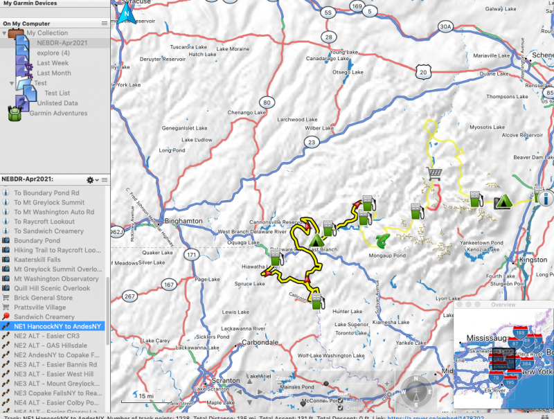
Google maps is the go to, but can’t export to gps devices and my device( Garmin In Reach) don’t support routing. Apps like Calimoto handle routing but don’t allow offroad/unknown roads. So.. It’s like a super map I guess? I use it to plot a main route, customize the detours where I want, mark gas stations and pit stops and them import to my device as a track. (again my device lacks “routing”) The same file can also go to calimoto or other map apps of your choice that might support routing.
I’ve only started with basecamp, it’s honestly pretty tedious, but I couldn’t find another solution that let me:
- route roads
- plot offline route
- import/export gps

Getting Free Street & Trail Maps for Garmin Basecamp
- Download basecamp. Oh you did already?
- Make sure “Map Manager” was installed as well
- Visit http://www.gmaptool.eu/en/content/usa-osm-topo-routable and pick your region
- Install 7z to unzip (let me know if this is a hurdle for anyone)
- double-click the *.gmap file you’re left with. Garmin Map Manager will prompt to install.
- Start or Re-start Garmin Basecamp to see the map show up as an option!
Calimoto
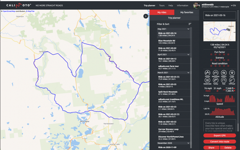
Why? Calimoto offers route planning and tracking both on web and app. It has a “curvy meter” and automatically plots route to varying degrees of windiness. I really like planning online on my computer where it’s easy, and knowing it’s automatically synced to the app on my phone for the next ride.
You can also automatically add any photos to the route and rate it when complete. The downside is lack of map detail and complete refusal to support offroad tracking (it just starts ignoring until your on road again)

Garmin MapShare (explore.garmin.com)
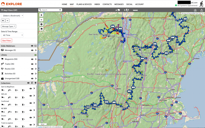
Why? It’s the proprietary site for my GPS Messenger/Navigator, the Garmin InReach. It’s not bad, allows me to track routes (though too painful without routing for long trips) and share with family/friends, including my live tracks. This was my key usecase as an emergency messenger/tracker for my solo riding. But I find I am using it more for route navigation since I can load up really nice Topo & Ariel & Road mixed maps on the paired Earthmate app on my phone.
